To date virtually all attention has been focused on the tsunami and on a tsunami warning center serving the Pacific region rather than on a U.S.-based service that monitors seismic activity globally, this in a context where the tsunami was generated by a massive earthquake.
Why the diverting of attention? Why the silence?
There is one over-riding disturbing fact about the recent tsunami disaster in the Indian Ocean.
Why was nobody warned?
After all the earthquake was almost certainly felt at Phuket (Thailand), while the tsunami that it provoked took almost 7 hours to reach the African coast. And even Sri Lanka was one and a half hours away. What happened? After all, there is a close link between underwater seismic activity and tsunamis, particularly in regions of considerable tectonic instability.
Certainly there is no equivalent of the Pacific Tsunami Warning Center in the Indian Ocean, there are no sensors on the sea bed and no buoys on the ocean surface designed to detect tsunamis, and there is no organized group of nations there to which tsunami alerts can be sent and who in turn have warning systems in place along their own coastlines and in communities at risk. In other words, there is no International Tsunami Warning System in operation in the Indian Ocean. However, a number of Indian Ocean nations are members of the Pacific-centered system, notably Australia, Philippines, Singapore... and Indonesia and Thailand!
Ironically, the PTWC , physically located in Honolulu, detected the earthquake off Sumatra immediately and, within 15 minutes of the event, sent out a bulletin advising that �there was no tsunami threat to the Pacific nations that participate in the Tsunami Warning System in the Pacific (ITSU) �. Two and one-half hours after the earthquake PTWC learned of tsunami damage in Sri Lanka via news reports and this led it to informing US military command in Hawaii of tsunami activity in the Indian Ocean. Another half hour later, the Center received a call from the US Ambassador in Sri Lanka asking it �to set up a notification system in case of big aftershocks.� A little over 7 hours after the initial earthquake PTWC, through the US State Department, set up a conference call with US embassies in Madgascar and Mauritius!!
It is a strange sequence of events given the very close causal relationship that exists between seismic activity and tsunamis and the fact that the former is monitored globally by a network centered in the United States.
Tsunamis are typically provoked by large, shallow earthquakes whose epicenter is on the ocean floor. At 07h59 local time an earthquake measuring 9.0 on the Richter Scale occurred some 150 km west of northern Sumatra. Although located at considerable depth � 5.6 km below the surface � this earthquake was massive in terms of its geographical dimensions. The interface between the Indo-Australian and Eurasian tectonic plates shifted some 10-15 m over a length of 500-600 km, resulting in the sea floor being raised several meters.
A few minutes after having been struck by the earthquake, the shock waves, traveling at up to 700 km/hr, hit the coast of Aceh, penetrating up to 10 km inland. Clearly no warning was possible there. In the case of Thailand it was already a different matter. 800 km from the epicenter, the earthquake was also undoubtedly felt at Phuket, but the subsequent tidal wave took 40 minutes or so to arrive.
Further afield, it took close to two hours to reach the coasts of Sri Lanka and India, four hours to the Maldives and seven to eight hours to the west coast of Africa. There was surely plenty of time to give some meaningful forward warning, particularly in view of the fact that all nations have some kind of crisis management structure?
The Seismographic Network
A global seismographic network has been developed by the Incorporated Research Institutions for Seismology (IRIS) , a US university research consortium with headquarters in Washington D.C. and financed principally by the US National Science Foundation. The consortium coordinates 128+ (often unmanned) seismic monitoring stations worldwide. The Institute of Geophysics and Planetary Physics at the University of California, San Diego, is a member of the consortium and it has developed, as a part of it, its own seismic monitoring programme, the International Deployment of Accelerometers project. IDA has 40 stations worldwide , four of which are located in the Indian Ocean: COCO (Cocos [Keeling] Islands ), PALK (Sri Lanka), MSEY (Seychelles) and DGAR (Diego Garcia).
The Diego Garcia station , located on an atoll leased by the British to the Americans and transformed by the latter into a major naval and air force facility, is the most recent facility to have been established by the IDA project, becoming operational in late January 2004.
IRIS/IDA Global Seismographic Network
This map shows the location of the 40 stations operated by Project IDA for the IRIS Consortium. The latest station in the network established in Feb 2004 is Diego Garcia, DGAR..
Source: http://ida.ucsd.edu/IDANetwork/index.html (click map to get Station information)
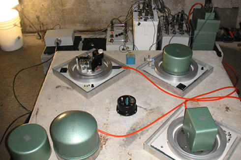
The Seismic Station At Diego Garcia established in Feb 2004 transmits data to IRIS and NEIC
|
|
The seismic monitoring stations transmit data back on a continuous basis to the IRIS Data Management Center in Seattle and to the World Data Center of the National Earthquake Information Center in Denver, USA.
The National Earthquake Information Center (NEIC) i s, in its own words, �responsible for determining, as rapidly and as accurately as possible, the location and size of all destructive earthquakes that occur worldwide; and collecting and providing an extensive seismic database.�
Presumably these data are not assembled uniquely for academic purposes, but rather in order to rapidly transmit information on to regions and populations at risk. Presumably also both centers were operational on the evening of the 25th and the morning of 26th of December. And presumably information on the earthquake in question was transmitted to them from the Indian Ocean monitors.
That being the case, it is vital to know what happened to that information, how it was treated, and whether any disaster warnings were conveyed to nations at risk in the Indian Ocean.
Something went badly wrong in the chain of information flow from the seismic monitors to the data management centers and back to the places affected.
Why?
Why weren�t the populations, particularly of Sri Lanka, India, the Maldives and East Africa given prior warning?
After all, the military authorities on Diego Garcia were informed....
| National Earthquake Information Center
The National Earthquake Information Center (NEIC), a part of the Department of the Interior, U.S. Geological Survey, is located in Golden, Colorado, 10 miles west of Denver. The National Earthquake Information Center (NEIC), was established in Rockville, Maryland, in 1966 as part of the National Ocean Survey of the Department of Commerce. The Coast and Geodetic Survey, a forerunner of the National Ocean Survey, had coordinated the collection of seismological data in the United States for many years. The NEIC was transferred to Boulder, Colorado, in 1972 and made part of the U.S. Geological Survey in 1973. The NEIC was moved again in 1974 to its present location in Golden, Colorado. |
Eric Waddell is Professor of Geography at Laval University, Qu�bec and a Global Research Associate.
Related Articles
US island base given warning: Bulletins sent to Diego Garcia 'could have saved lives' Richard Norton-Taylor
Foreknowledge of a Natural Disaster: Washington was aware that a deadly Tidal Wave was building up in the Indian Ocean, Michel Chossudovsky